KOLKATA
KOLKATA
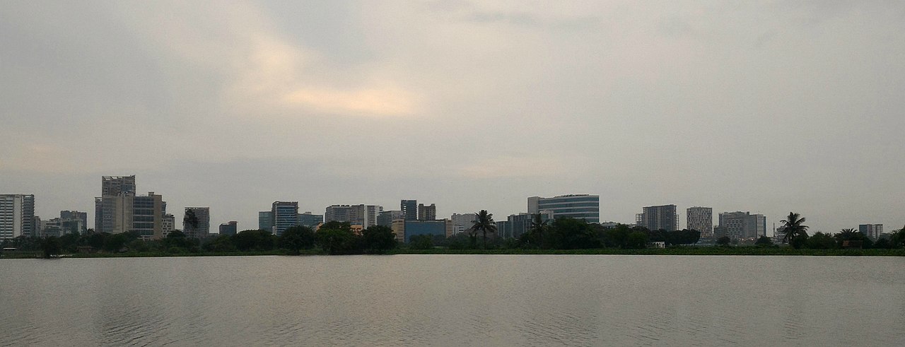
Kolkata is the capital and the largest city of the Indian state of West Bengal. Located on the banks of the Hooghly River, the city is approximately 80 kilometres (50 mi) west of the border with Bangladesh. It is the primary business, commercial, and financial hub of Eastern India and the main port of communication for North-East India.[19] According to the 2011 Indian census, Kolkata is the seventh-most populous city in India, with a population of 4.5 million residents within the city limits, and a population of over 14.1 million residents in the Kolkata Metropolitan Area. It is the third-most populous metropolitan area in India. In 2021, Kolkata metropolitan area crossed 15 million registered voters. The Port of Kolkata is India’s oldest operating port and its sole major riverine port. Kolkata is regarded as the cultural capital of India.[1][20]
In the late 17th century, the three villages that predated Calcutta were ruled by the Nawab of Bengal under Mughal suzerainty. After the Nawab granted the East India Company a trading licence in 1690,[21] the area was developed by the Company into an increasingly fortified trading post known as Fort William. Nawab Siraj ud-Daulah occupied Calcutta in 1756, and the East India Company retook it the following year
HISTORY

The discovery and archaeological study of Chandraketugarh, 35 kilometres (22 mi) north of Kolkata, provide evidence that the region in which the city stands has been inhabited for over two millennia.[29][30] Kolkata’s recorded history began in 1690 with the arrival of the English East India Company, which was consolidating its trade business in Bengal. Job Charnock, an administrator who worked for the company, was formerly credited as the founder of the city;[31] In response to a public petition,[32] the Calcutta High Court ruled in 2003 that the city does not have a founder.[33] The area occupied by the present-day city encompassed three villages: Kalikata, Gobindapur and Sutanuti. Kalikata was a fishing village; Sutanuti was a riverside weavers’ village. They were part of an estate belonging to the Mughal emperor; the jagirdari (a land grant bestowed by a king on his noblemen) taxation rights to the villages were held by the Sabarna Roy Choudhury family of landowners, or zamindars. These rights were transferred to the East India Company in 1698.
GEOGRAPHY
Spread roughly north–south along the east bank of the Hooghly River, Kolkata sits within the lower Ganges Delta of eastern India approximately 75 km (47 mi) west of the international border with Bangladesh; the city’s elevation is 1.5–9 m (5–30 ft).[62] Much of the city was originally a wetland that was reclaimed over the decades to accommodate a burgeoning population.[63] The remaining undeveloped areas, known as the East Kolkata Wetlands, were designated a “wetland of international importance” by the Ramsar Convention (1975).[64] As with most of the Indo-Gangetic Plain, the soil and water are predominantly alluvial in origin. Kolkata is located over the “Bengal basin”, a pericratonic tertiary basin.[65] Bengal basin comprises three structural units: shelf or platform in the west; central hinge or shelf/slope break; and deep basinal part in the east and southeast. Kolkata is located atop the western part of the hinge zone which is about 25 km (16 mi) wide at a depth of about 45,000 m (148,000 ft) below the surface.[65] The shelf and hinge zones have many faults, among them some are active. Total thickness of sediment below Kolkata is nearly 7,500 m (24,600 ft) above the crystalline basement; of these the top 350–450 m (1,150–1,480 ft) is Quaternary, followed by 4,500–5,500 m (14,760–18,040 ft) of Tertiary sediments, 500–700 m (1,640–2,300 ft) trap wash of Cretaceous trap and 600–800 m (1,970–2,620 ft) Permian-Carboniferous Gondwana rocks.[65] The quaternary sediments consist of clay, silt and several grades of sand and gravel. These sediments are sandwiched between two clay beds: the lower one at a depth of 250–650 m (820–2,130 ft); the upper one 10–40 m (30–130 ft) in thickness.[66] According to the Bureau of Indian Standards, on a scale ranging from I to V in order of increasing susceptibility to earthquakes, the city lies inside seismic zone III.

ECONOMY
Kolkata is the commercial and financial hub of East and North-East India[70] and home to the Calcutta Stock Exchange.[95][96] It is a major commercial and military port, and is the only city in eastern India, apart from Bhubaneswar to have an international airport. Once India’s leading city, Kolkata experienced a steady economic decline in the decades following India’s independence due to steep population increases and a rise in militant trade-unionism, which included frequent strikes that were backed by left-wing parties.[61] From the 1960s to the late 1990s, several factories were closed and businesses relocated.[61] The lack of capital and resources added to the depressed state of the city’s economy and gave rise to an unwelcome sobriquet: the “dying city”.[97] The city’s fortunes improved after the Indian economy was liberalised in the 1990s and changes in economic policy were enacted by the West Bengal state government.[61] Recent estimates of the economy of Kolkata’s metropolitan area have ranged from $150 to $250 billion (PPP GDP), and have ranked it third-most productive metro area of India.
ahmedabad DISTRICT'S
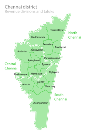
Chennai district, formerly known as Madras district,[a] is one of the 38 districts in the state of Tamil Nadu, India. It is the smallest and most densely populated district in the state. The district is coterminous with the city of Chennai, which is administered by the Greater Chennai Corporation. It is surrounded by Tiruvallur district in the north and the west, Kanchipuram district in the south-west, Chenglpattu district in the south, and the Bay of Bengal in the east.
As of 2011, the district had a population of 7,100,000 with a sex-ratio of 989 females for every 1,000 males.[3] Much of the district’s population descended from its settlements in the 1st century CE to the Middle Ages, but the diversity has grown much since then. The district consists of only one civic body, the megacity of Chennai, which forms the core and the most notable portion of the much bigger Chennai metropolis, or officially, the Chennai Metropolitan Area. In 2018, the district’s limits were expanded, aligning with that of the newly expanded Greater Chennai Corporation, which annexed adjacent municipalities. It resulted in the area being increased from 175 square kilometres (68 sq mi) to 426 square kilometres (164 sq mi).[1][2] The district is divided into three revenue divisions and ten taluks.
more info
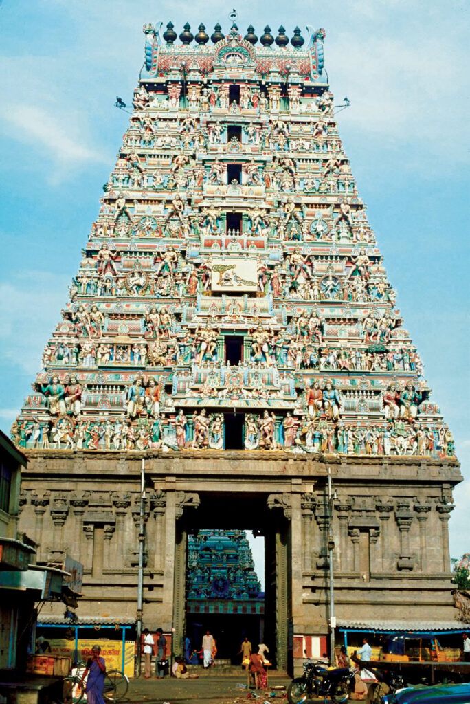
Chennai, formerly Madras, city, capital of Tamil Nadu state, southern India, on the Coromandel Coast of the Bay of Bengal. Known as the “Gateway to South India,” Chennai is a major administrative and cultural centre. Pop. (2001) city, 4,343,645; urban agglom., 6,560,242.Armenian and Portuguese traders were living in the San Thome area of what is now present-day Chennai before the arrival of the British in 1639. Madras was the shortened name of the fishing village Madraspatnam, where the British East India Company built a fort and factory (trading post) in 1639–40. At that time, the weaving of cotton fabrics was a local industry, and the English invited the weavers and native merchants to settle near the fort.
demographics
The demonym for residents of Kolkata are Calcuttan and Kolkatan. According to provisional results of the 2011 national census, Kolkata district, which occupies an area of 185 km2 (71 sq mi), had a population of 4,486,679;[113] its population density was 24,252/km2 (62,810/sq mi).[113] This represents a decline of 1.88% during the decade 2001–11. The sex ratio is 899 females per 1000 males—lower than the national average.[114] The ratio is depressed by the influx of working males from surrounding rural areas, from the rest of West Bengal; these men commonly leave their families behind.[115] Kolkata’s literacy rate of 87.14%[114] exceeds the national average of 74%.[116] The final population totals of census 2011 stated the population of city as 4,496,694.[9] The urban agglomeration had a population of 14,112,536 in 2011.
Bengali, the official state language, is the dominant language in Kolkata.[118] English is also used, particularly by the white-collar workforce. Hindi and Urdu are spoken by a sizeable minority.[119][120] Bengali Hindus form the majority of Kolkata’s population; Marwaris, Biharis and Urdu-speaking Muslims compose large minorities.[121] Among Kolkata’s smaller communities are Chinese, Tamils, Nepalis, Pathans/Afghans (locally known as Kabuliwala[122]) Odias, Telugus, Gujaratis, Anglo-Indians, Armenians, Bengali Muslims, Greeks, Tibetans, Maharashtrians, Konkanis, Malayalees, Punjabis and Parsis.[34]: 3 The number of Armenians, Greeks, Jews and other foreign-origin groups declined during the 20th century.[123] The Jewish population of Kolkata was 5,000 during World War II, but declined after Indian independence and the establishment of Israel;[124] by 2013, there were 25 Jews in the city.[125] India’s sole Chinatown is in eastern Kolkata;[123] once home to 20,000 ethnic Chinese, its population dropped to around 2,000 as of 2009[123] as a result of multiple factors including repatriation and denial of Indian citizenship following the 1962 Sino-Indian War, and immigration to foreign countries for better economic opportunities.[126] The Chinese community traditionally worked in the local tanning industry and ran Chinese restaurants.
| Population of Kolkata | |||
|---|---|---|---|
| Census | Population | %± | |
| 1901 | 1,009,853 | — | |
| 1911 | 1,117,966 | 10.7% | |
| 1921 | 1,158,497 | 3.6% | |
| 1931 | 1,289,461 | 11.3% | |
| 1941 | 2,352,399 | 82.4% | |
| 1951 | 2,956,475 | 25.7% | |
| 1961 | 3,351,250 | 13.4% | |
| 1971 | 3,727,020 | 11.2% | |
| 1981 | 4,126,846 | 10.7% | |
| 1991 | 4,399,819 | 6.6% | |
| 2001 | 4,572,876 | 3.9% | |
| 2011 | 4,496,694 | −1.7% | |
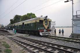
transport
rail
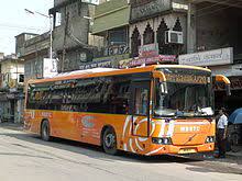
Calcutta State Transport Corporation (CSTC) was a West Bengal state government undertaken transport corporation. Headquartered in Kolkata, it was set up on 31 July 1948.[1] Currently it operates under the name WBTC. It plied buses in Kolkata and nearby districts of West Bengal, along with some long-distance services. CSTC owned 11 depots in Kolkata and the districts to station its fleet of busses.
road
Calcutta State Transport Corporation (CSTC) was a West Bengal state government undertaken transport corporation. Headquartered in Kolkata, it was set up on 31 July 1948.[1] Currently it operates under the name WBTC. It plied buses in Kolkata and nearby districts of West Bengal, along with some long-distance services. CSTC owned 11 depots in Kolkata and the districts to station its fleet of busses.
AIRPORT
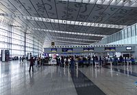
Netaji Subhas Chandra Bose International Airport, located in Dum Dum, about 16 km (9.9 mi) north-east of the city centre, operates domestic and international flights. In 2013, the airport was upgraded to handle increased air traffic.
RESEDENTIAL AREAS
BLANK MAM

lal darwaza market
The New Market, formerly known as Sir Stuart Hogg Market,[2] is a market in Kolkata situated on Lindsay Street, beside Free School Street (Mirza Ghalib Street/Rani Rasmoni Road). Although primarily “New Market” referred to the original enclosed market, today in local parlance, the entire shopping area is often known as “New Market”.
Some of the earliest English quarters of Calcutta were in an area known then as Dalhousie Square. Terretti and Lalbazar nearby were the customary shopping haunts of the British. Later settlements arose in Kashaitola, Dharmatala and Chowringhee.
SHOPPING MALL (koyambedu MALL)
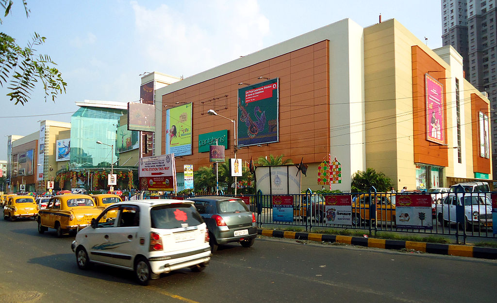
South City Mall is a shopping mall in South Kolkata, West Bengal. Located at Prince Anwar Shah Road, Jadavpur (where the erstwhile Usha Industries factories and staff quarters were situated), it has been open since 16 January 2008.[1] It has a Gross Leasable Area of 1,000,000 sq ft (93,000 m2)[2] and parking for 2,500 vehicles.[3]
The mall was designed by retail specialist ICS Bentel Associates. Anchored by major stores like Pantaloons, Spencer’s Retail and Shoppers Stop, there are also 134 other stores, a food court on the top floor and an INOX multiplex.
The adjoining South City Township, with four 35-storey and one 15-storey residential highrises, was built by the same developer – South City Projects.
MOVIE THREATERS
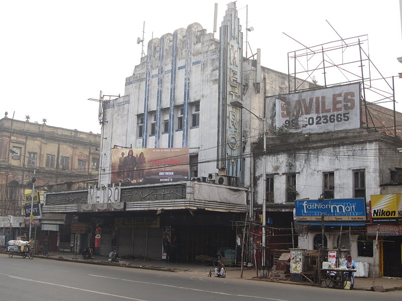
Metro Cinema or Metro Cinemas is a uniplex cinema hall and a heritage building located in Jawahar Lal Nehru Road (Esplanade), Kolkata, West Bengal, India.[1] This theatre was opened by Metro-Goldwyn-Mayer in 1935.[2] It is currently owned by a Mumbai-based firm and is undergoing a renovation to be converted into a multiplex theatre. The building is located in the posh Esplanade area of Kolkata, right at the heart of the city. It is a heritage structure and a very famous landmark of the city of Kolkata. And one of the many famous cinema halls in the Esplanade area of Central Kolkata.
PARKs
Eco Park (or Prakriti Tirtha) is an urban park in New Town, Rajarhat, Kolkata and the biggest park so far in India.[2] The park is situated on a 480 acres (190 ha) plot and is surrounded by a 104 acres (42 ha) waterbody with an island in the middle.[3] The park was conceptualised by Chief Minister of West Bengal, Mamata Banerjee in July 2011.[4] West Bengal Housing Infrastructure Development Corporation (HIDCO) is the overarching body coordinating the construction of the park, along with different other government bodies responsible for implementation of different works inside the park.

HOSPITALS
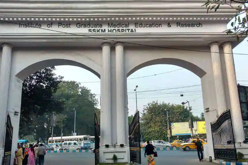
IPGMER and SSKM Hospital, or in its full name Institute of Post-Graduate Medical Education and Research and Seth Sukhlal Karnani Memorial Hospital, colloquially known as P. G. Hospital (Presidency General Hospital), also known as PGI KOLKATA, is a government medical school and tertiary referral government hospital for the state of West Bengal, India and is a national research institute.
Located near Race Course ground and the Victoria Memorial Hall of Kolkata, its location is in the heart of Kolkata surrounded by cultural and historical landmarks like the Nandan complex, Rabindra Sadan, Academy of Fine Arts the Saint Paul’s Cathedral, the Red Road and the Indian Museum. It faces the Maidan of Kolkata – a hot-spot for political rallies in the city.
KOLKATA LOCAL AREAS
Agarpara
Alambazar
Alipur Road
Anandpur
Andul Road
Ariadaha
Ashok Nagar
Badartala
Bagbazar
Baghajatin
Baguiati
Bally
Ballygunge
Bamangachi
Bandel
Bansdroni
Bara Bazar
Barisha
Barrackpore
BT Road
Baruipur
Batanagar
Beck Bagan
Behala
Belgachia
Belgharia
Beliaghata
Belur
Bhadreswar
Bijoygarh
Birati
Biren Roy Road West
Boral
Bowbazar
Budge Budge Road
Canning
Chandannagar
Chandni Chowk
Chetla
Chitpur
Chowringhee
College Street
Dakshindari
B B D Bagh
Dankuni
Dasnagar
Dhakuria
Dhapa
Diamond Harbour Road
Domjur
Dum Dum
Dum Dum Cantt
Dum Dum Park
Dum Dum Road
Dunlop
Elgin
Entally
G.T. Road
Ganguli Bagan
Garden Reach
Garfa
Garia
Gariahat
Ghusuri
Golf Green
Golpark
Dharmatala
Haltu
Harish Mukherjee Road
Hastings
Hati Bagan
Hatkhola
Hazra Road
Hindustan Park
Hooghly
Howrah
Ichapur
Jadavpur
James Long Sarani
Jessore Road
Jodhpur Park
Joka
Jorabagan
Jorasanko
Kaikhali
Kalighat
Kalikapur
Kalitala
Kalyani
Kanchrapara
Kankurgachi
Kasba
Kashipur
Kazipara
Keshtopur
Khardaha
Khidirpur
Konnagar
Krishnapur
Kudghat
Kustia
Lake Gardens
Lake Market
Lake Town
Liluah
Machuabazar
Madhyamgram
Maharsi Debendra Road
Mahatma Gandhi Road
Maheshtala
Maidan
Majherhat
Mullick Bazar
Maniktala
Metiabruz
Mominpore
Mukundapur
Nabapally
Nadia
Nagerbazar
Naihati
Naktala
Narendrapur
Narkeldanga
Netaji Nagar
Netaji Subhas Chandra Bose Road
New Alipore
Nimta
Noapara
Paikpara
Panchashyar
Panihati
Park Circus
Park Street Area
Parnasree Pally
Paschim Putiary
Patipukur
Phool Bagan
Poddar Nagar
Prince Anwar Shah Road
Purba Barisha
Purba Putiari
Purna Das Road
Rabindra Sarani
Raghunathpur
Roy Bahadur Road
Raja Rammohan Roy Sarani
Raja Subodh Chandra Mullick Road
Rajarhat
Rajarhat Road
Rajdanga Gardens
Rash Behari Avenue
Rathtala
Regent Estate
Regent Park
Rishra
Sahapur
Salkia
Salt Lake City
Santoshpur
Santragachi
Sarat Bose Road
Sarsuna
Satgachhi
Sealdah
Selimpur
Serampore
Shibpur
Shobhabazar
Shyam Nagar
Simla
Sinthee
Sodepur
Southern Avenue
Subhasgram
Tala
Taltala
Tangra
Taratala
Teghoria
Thakurpukur
Tikiapara
Tiljala
Tiretti
Titagarh
Tollygunge
Topsia
Ultadanga
Uluberia
Uttarpara
VIP Road
Vivekananda Sarani
Madurdaha
E.M. Bypass
EM Bypass
Baidyabati
Garcha
Ramchandrapur
Panditya Road
Bondel Road
Buroshibtalla
Patuli
Burdwan Road
Bantala
Hatiara Road
Bhowanipore
Brahmapur
Kona Expressway
Ghuni
South End Park
Golaghata
Rabindrapally
B L Saha Road
Nayabad
Haldia
Dakshineswar
Alipore
Srinagar
Bakultala
APC Road
Chinar Park
Laskarpur
Malancha Mahi Nagar
Bablatala
Harinavi
Gobra
Kamalgazi
Rajpur Chowhati
Singur
New Barrakpur
New Town Action Area-I
Rajpur Sonarpur
Raja Ram Mohan Roy Road
Rekjuani
Pailan
Beniapukur
Kamarpukur
Subhash Nagar
Khariberia
New Town Action Area-III
Mandirtala
Amtala
Bikramgarh
East Kolkata Township
Atapara
Tagore Park
Baranagar
Chowbaga
Sector 3
Berunanpukhuria
Barasat
Raichak
Picnic Garden
Champahati
Sector V
Ajoy Nagar
Maslandapur
Sakher Bazar
Narayanpur
Arambagh
Sarat Chatterjee Rd
Ramgarh
Hasnabad
Mankundu
Amtala-Baruipur Road
Muchipara
Ghosh Para Road
Nandi Bagan
Rabindra Nagar
Sreerampur
Champdani
Samali
Sripur
Purbalok
Makardaha
Bishnupur
Ramrajtala
Hridaypur
Ganganagar
New Town Action Area-II
Bongaon
Bangur
Habra
Bakkhali
AJC Bose Road
Basirhat
Beniatola
Telipukur
Nazirabad
Kamdahari
Bagmari
Ram Bagan
North Dum Dum
Parui Mauza
Bhawanipur
Dhamua
Kulerdari
Andharmanik
Duttapukur
New Garia
Rasapunja
Jharkhali
Tegharia
Hatiara
Haringhata
Karimpur
Chakdaha
Sonarpur
Prince Anwar Shah Road Connector
New Town
Kalikapur Rajpur Sonarpur
Maula Ali
Godkhali
EM Bypass Connector
Purbachal
Rash Behari Ave Connector
Khanna
BBT Road
Pansila
Halisahar
Julpia
Birlapur
Malancha Bazar
Durga Nagar
Cossipore
Hazra
Haridevpur
Jalkal
Rajpur
Feeder Road
Sankharipota
Raypur
Bakhrahat Road
Bibirhat
Budge Budge
Bonhooghly
Putuapara
Rahara
Jagatipota
Bedibhawan
Palta
Bidhanpally
Bankra
Pandua
Jawpur
Michael Nagar
Guptipara
Jagatdal
Bidhannagar
VIP Nagar
Mahishgote
Raja Bazar
Panpur
Kheyadah
Chingrighata
Bhatpara
Bow Barracks
Gaighata
Garulia
Kamarhati
North Barrackpur
Panchpota
Sukanta Pally
South 24 Parganas
Mahamaya Tala
Naoabad
Paschim Barisha
Hindmotor
Metropolitan
Dashadrone
WE HELP YOU TO SELL
PHONE
+91-7558348349
info@retailmarketing.co.in
ADDRESS
:- Shriram Niwas, 261, Bahirat Galli, Gaothan, Shivajinagar, Pune, Maharashtra 411005 :- infinity mall, Phase D, Shastri Nagar, Andheri West, Mumbai, Maharashtra 400047 :- Haware Fantasia Business Park, 47, near, Inorbit Bypass, Sector 30A, Vashi, Navi Mumbai, Maharashtra 400703