Skip to content

NAGPUR

NAGPUR

Nagpur  is the third largest city and the winter capital of the Indian state of Maharashtra. It is the 13th largest city in India by population[18] and according to an Oxford’s Economics report, Nagpur is projected to be the fifth fastest growing city in the world from 2019 to 2035 with an average growth of 8.41%. It has been proposed as one of the Smart Cities in Maharashtra and is one of the top ten cities in India in Smart City Project execution.

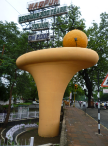
In the latest rankings of 100 developing smart cities given by the Union Ministry of Urban Development, Nagpur stood first in Maharashtra state and second in India. Known as the “Orange City”, Nagpur has officially become the greenest, safest, and technologically developed city in the Maharashtra state.

HISTORY

 
statue of Bakht Buland Shah in Nagpur

The king who actually founded Nagpur was Bakht Buland Shah of Deogarh. An able administrator, he incentivised large-scale immigration of Marathi Hindu cultivators to increase economic activity. After Bhakt Buland Shah, the next Raja of Deogarh was Chand Sultan, who resided principally in the country below the hills, fixing his capital at Nagpur, which he turned into a walled town. On Chand Sultan’s death in 1739, Wali Shah, an illegitimate son of Bakht Buland, usurped the throne and Chand Sultan’s widow invoked the aid of the Maratha leader Raghoji Bhosale of Berar in the interest of her sons Akbar Shah and Burhan Shah. The usurper was put to death and the rightful heirs placed on the throne. After 1743, a series of Maratha rulers came to power, starting with Raghoji Bhosale, who conquered the territories of Deogarh, Chanda and Chhattisgarh by 1751. Nagpur was burnt substantially in 1765 and again partially in 1811 by marauding Pindaris. However, the development of the city of Nagpur continued.  In 1803 Raghoji II Bhosale joined the Peshwa against the British in the Second Anglo-Maratha War, but the British prevailed. After Raghoji II’s death in 1816, his son Parsaji was deposed and murdered by Mudhoji II Bhosale.

GEOGRAPHY

Nagpur is located at the exact centre of the Indian subcontinent, close to the geometric center of the quadrilateral connecting the four major metros of India, viz. Chennai, Mumbai, New Delhi and Kolkata. The city has the Zero Mile Stone locating the geographical centre of India, which was used by the British to measure all distances within the Indian subcontinent.

The city lies on the Deccan plateau of the Indian subcontinent and has a mean altitude of 310.5 meters above sea level.[62] The underlying rock strata are covered with alluvial deposits resulting from the flood plain of the Kanhan River. In some places, these give rise to granular sandy soil. In low-lying areas, which are poorly drained, the soil is alluvial clay with poor permeability characteristics. In the eastern part of the city, crystalline metamorphic rocks such as gneiss, schist and granites are found, while in the northern part yellowish sandstones and clays of the lower Gondwana formations are found.[63] Nagpur city is dotted with natural and artificial lakes.

 
Vidhan Bhavan (State Legislative Assembly) Nagpur

ECONOMY

Nagpur is an emerging metropolis. Nagpur’s GDP was estimated to be around $33 Billion in 2021 making it the largest economic center in entire central India.[128] In 2004, it was ranked the fastest-growing city in India in terms of the number of households with an annual income of ₹1 crore (10 million) or more.[129] Nagpur has been the main centre of commerce in the region of Vidarbha since its early days and is an important trading location. Although, Nagpur’s economic importance gradually declined relative to Mumbai and Pune after the merging of Vidarbha into Maharashtra because of a period of neglect by the state government, the city’s economy later recovered.[130]

 
Sitabuldi Market, one of the busiest commercial areas of Nagpur
 
Nagpur branch of the Reserve Bank of India
Nagpur city had attracted ₹5000 crore worth of investment in 2004.[131][132] Its per capita income was ₹123,610 (US$1,700) in 2015 and its GDP was estimated to be $15.10 billion in 2016.

NAGPUR CITY DISTRICT

Nagpur district (Marathi pronunciation: [naːɡpuːɾ]) is a district in the Vidarbha region of Maharashtra state in central India. The city of Nagpur is the district administrative centre. The district is part of Nagpur Division.

Nagpur district is bounded by Bhandara district on the east, Chandrapur district on the southeast, Wardha district on the southwest, Amravati district on the northwest and Chhindwara district of Madhya Pradesh state on the north.

demographices

As of the 2011 census, Nagpur municipality has a population of 2,405,665. The total population constitute, 1,225,405 males and 1,180,270 females. The total children (ages 0–6) are 247,078, of whom 128,290 are boys and 118,788 are girls. Children form 10.27% of total population of Nagpur. The total number of slums number 179,952, in which 859,487 people reside. This is around 35.73% of the total population of Nagpur. The municipality has a sex ratio of 963 females per 1,000 males and child sex ratio of 926 girls per 1,000 boys. 1,984,123 people are literate, of whom 1,036,097 are male and 948,026 are female. Average literacy rate of Nagpur city are 91.92%. Men are 94.44% and women are 89.31% literate.

Nagpur CityTotalMaleFemale
City Population2,405,6651,225,4051,180,260
Literates1,984,1231,036,097948,026
Children (0-6)247,078128,290118,788
Average Literacy (%)91.92 %94.44 %89.31 %
Sexratio963 
Child Sexratio926 

transport

TRAINS

Railways started in Nagpur way back in 1867 when portion of Bombay-Bhusaval-Nagpur line was opened for traffic and train service from Nagpur to Calcutta was started in 1881.[310][311] Today, a total of 254 trains stop at Nagpur railway station. These include passenger, express, mail, Duronto, Rajdhani, Garib Rath trains. Of these 65 are daily trains and 22 terminate/originate from Nagpur.

BUS

Nagpur is a major junction for roadways as India’s two major national highways, Srinagar-Kanyakumari (National Highway 44) and Mumbai-Kolkata (NH 53(Economic Corridor1(EC1)) pass through the city.[324] National Highway 47 connects Nagpur to Bamanbore in Gujrat. Nagpur is at the junction of two Asian Highways namely AH43 Agra to Matara, Sri Lanka and AH46 connecting Kharagpur, India to Dhule, India. The highway to Mumbai via Aurangabad, a shorter route, was re-built on the national highway basis. This highway significantly reduces the distance travelled by NH 6 and NH 3 between two cities. 

AIRPORT

Dr. Babasaheb Ambedkar International Airport (IATA: NAG, ICAO: VANP) is operated by Mihan India Private Limited (MIPL) and owned by Airports Authority of India.[333]

Nagpur’s Air Traffic Control (ATC) is the busiest in India, with more than 300 flights flying over the city every day in 2004.[334] In October 2005, Nagpur’s Sonegaon Airport was declared an international airport and was renamed Dr. Babasaheb Ambedkar International Airport.

MARKET

Sadar bazaar is one of the shopping places in Nagpur that is highly frequented by the locals as well as tourists in the city. From clothing to footwear and cosmetics, you will find everything here at the best prices. This market area is also popular for the wooden crafts, which are manufactured by the local craftsmen.

SHOPPING MALL

Being this biggest mall in Nagpur, Empress mall is popular among the residents of the city. This extravagant mall houses international brands like Tommy Hilfiger, Gucci, Versace, etc. and national brands like Pantaloons, Lifestyle, Big Bazar, Global Desi and many more. This massive mall in Nagpur also has PVR Cinemas. It is at a prime location, and thus, is easily accessible from all parts of the city.

MOVIE THREATERS

Sudama Theatre – Dharampeth is a popular theatre located at West High Court Road, Near Punjab National Bank, Dharampeth, West, Nagpur. Sudama Theatre – Dharampeth has 1 screens. Movies now showing at Sudama Theatre – Dharampeth are NONE. Facilities available at Sudama Theatre – Dharampeth are Parking Facility.

PARKS

Pench Tiger Reserve or Pench National Park is one of the premier tiger reserves of India and the first one to straddle across two states – Madhya Pradesh and Maharashtra. The reference to Pench is mostly to the tiger reserve in Madhya Pradesh.

The portion of the reserve that is in Madhya Pradesh is nestled in the southern slopes of the Satpura range of Central India. Pench Tiger Reserve comprises the Indira Priyadarshini Pench National Park, the Pench Mowgli Sanctuary and a buffer. 

HOSPITALS

All India Institute of Medical Sciences, Nagpur (AIIMS Nagpur) is a medical research public higher education institute located at the Multi-modal International Cargo Hub and Airport at Nagpur (MIHAN), Nagpur, Maharashtra, India. It is one of the four “Phase-IV” All India Institutes of Medical Sciences (AIIMS) announced in July 2014.

NAGPUR LOCAL AREAS

RPTS Road
Shivaji Nagar
New Mankapur
Saroj Nagar
Umred Road
Hingna
Koradi Road
Wakeshwar
Wardha Road
Mihan
Godhni
Katol Road
Wanadongri
Vaishali Nagar
Dharampeth
Manish Nagar
Besa
Bharat Nagar
Ring Road
RUI
Panjri Lodhi
Amravati Road
Ramdaspeth
Shubhash Road
Pande Layout
Somalwada
Jafar Nagar
Anant Nagar
Dhantoli
Khasarmari
Degma
Nandanvan
Khadka
Buti Bori
Panjari
Hardoli
Ghogali
Chandan Nagar
Sitabuldi
Narendra Nagar
Ram Nagar
Abhyankar Nagar
Bhilgaon
Gorewada
Omkar Nagar
Borgaon
Narsala
Gayatri Nagar
Trimurti Nagar
Sneha Nagar
Takli
New Colony
Raj Nagar
Temple Road
Prashant Nagar
Parsodi
Zari
Gokulpeth
Rajendra Nagar
Kamptee Road
laxmi Nagar
Ganeshpeth Colony
Vayusena Nagar
Jamtha Wardha Road
Jaripatka
Hudkeshwar Road
Subhash Nagar
Civil Lines
Surendra Nagar
Gopal Nagar
Rahate Colony
Beltarodi
Wadi
Pratap Nagar
Sonegaon
Godhni road
Tamaswadi
Hingna Road
Khapari
Resham Bag
Ayodhya Nagar
Mhalgi Nagar
Umred
Kaldongri
Ambazari
Balaji Nagar
Wathoda
Lonara
Kanholi
Jamtha
Peotha
Sahakar Nagar
Unthkhana
Khamla
Dabha
Chikna
Bhansoli
Khadki
Ajni
Mohan Nagar
Byramji Town
Banwadi
Dhamna
Phukeshwar
Ashirwad Nagar
Tulsibag Road
KT Nagar
Mangli
Gandhi Nagar
Shankar Nagar
Wanjari Nagar
Dindayal Nagar
Bajaj Nagar
Hanuman Nagar
N.I.T. Layout
Samarth nagar
Vishwakarma Nagar
Shanti Nagar Colony
 
Prem nagar
Shilpa Society
Kalameshwar
Alagondi
Ladgaon
Belpeth
Pipla
Isasani
Shivmadka
Wagdara
Kotewada
Telecom Nagar
Jaiprakash Nagar
Deoli Gujar
Bhiwapur
Chargaon
Surabardi
Sindivihiri
Tambekhani
Kachimet
Wadadh
Pusagondi
Poonam Vihar
Itwari
Jaitala
Azamshah Layout
Pawangaon
Bezonbagh
Dongargaon
Clark Town
Mangalwari
Empress City
New Sneh Nagar
Duttawadi
Wardhaman Nagar Colony
Dighori
Savner
Mauda
Kalmana
Rameshwari
Kharbi
Raghuji Nagar
Pardi
Chandrapur
Zingabai Takli
Vivekanand Nagar
Besa Road
Mansar
Chandrakiran Nagar
Mominpura
Mahal
Tandapeth
Bagadganj
Nari
Kuhi
Lakadganj
Radhakishanpura
Siddharth Nagar
Uday Nagar
Kondhali
Bela
Khapa
New Indora
Teka Naka
Marajghat
Ramtek
Ansar Nagar
Chatrapati Nagar
Narkhed
Dixit Nagar
Bhartwada
Sadar
Shambhu Nagar
Police LineTakli
Hansapuri
Badil Kheda
Gorepeth
Manewada
Takalghat
Bajeria
S R P Camp
Gandhibagh
Bhokara
Patansaongi
Surve Nagar
Manav Seva Nagar
Bhagwan Nagar
Madhav Nagar
Surya Nagar
Seminary Hills
Angulimal Nagar
Shankarpur
Narbada Colony
Gumgaon
Swawlambi Nagar
Khadgaon
Balabhaupeth
Dangarpura
Binaki
Dahegaon
Khairy
Rambagh
Padole Nagar
Narsala Road
Bhandewadi
Besa-Pipla Road
Pipla Road
Kanhalgaon
Reshimbagh Main Road
Gotal Pajri
New Khapri
Borkhedi
Hudkeshwar Bk
Digdoh
Chinchbhawan
Katol
Khaperkheda
Turkmari
 

WE HELP YOU TO SELL

PHONE

+91-7558348349

Email

info@retailmarketing.co.in

ADDRESS

:- Shriram Niwas, 261, Bahirat Galli, Gaothan, Shivajinagar, Pune, Maharashtra 411005 :- infinity mall, Phase D, Shastri Nagar, Andheri West, Mumbai, Maharashtra 400047 :- Haware Fantasia Business Park, 47, near, Inorbit Bypass, Sector 30A, Vashi, Navi Mumbai, Maharashtra 400703